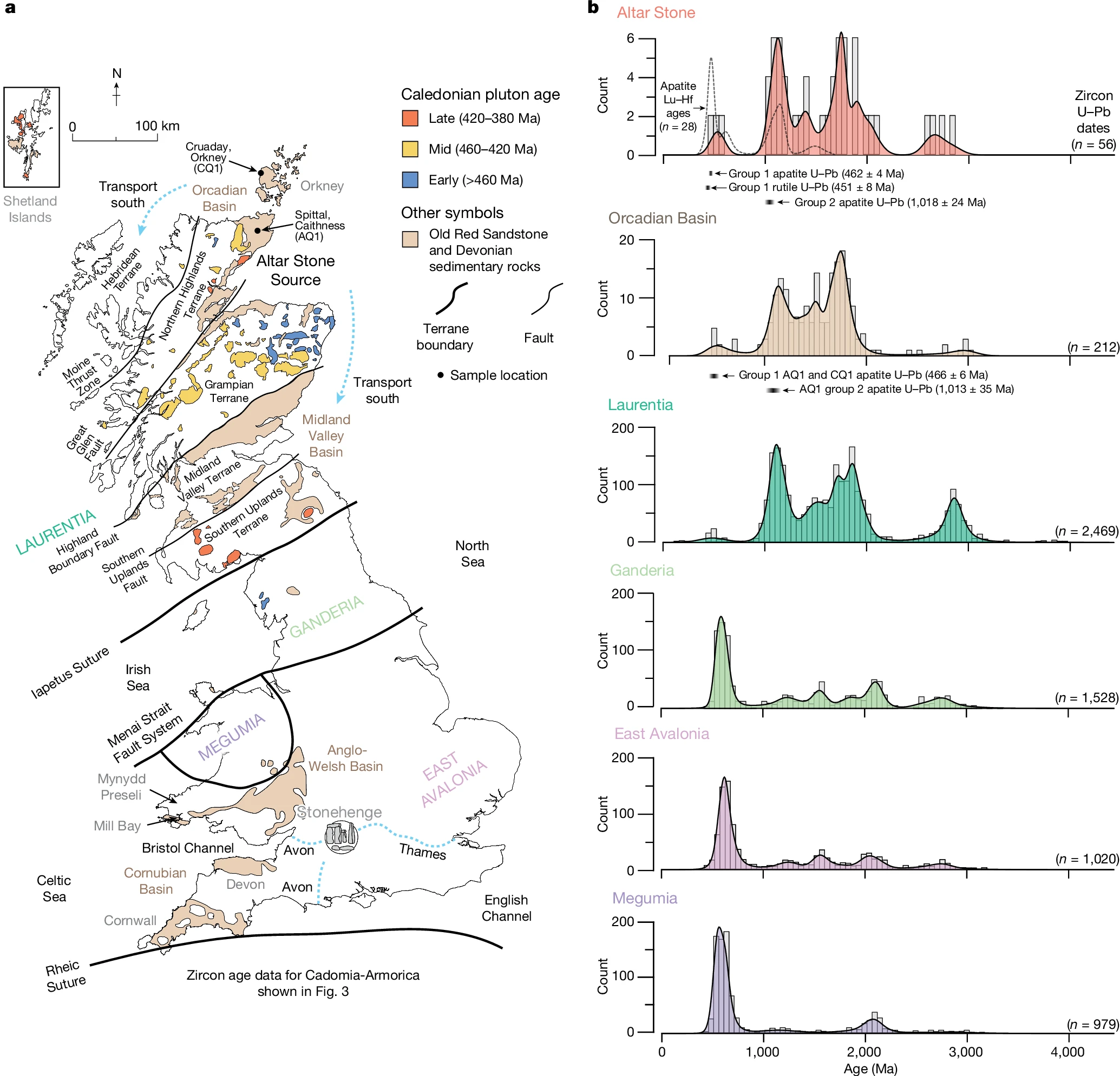
Friday, 8 August 2025

Evidence for the Glacial Transport Theory of Stonehenge

The Glacial Transport Theory posits that the bluestones (and potentially other megaliths) at Stonehenge were primarily moved from their Welsh origins to Salisbury Plain by glacial action during the Pleistocene, rather than through human effort, implying they were collected locally near Stonehenge as erratics rather than quarried, and/or collected, in Wales and transported. 

Below is a comprehensive list of key evidence types that could prove or disprove this theory (or render it likely/unlikely), based on geological, archaeological, and glaciological principles. For each, we indicate whether it supports or refutes the theory, and annotate whether such evidence has been found, with details drawn from scientific analyses.

Evidence Table

Evidence Type

Supports or Refutes Theory

Has It Been Found?

Details and Sources

Presence of bluestone glacial erratics (boulders of matching lithology) scattered across Salisbury Plain, outside the immediate Stonehenge environs

Supports (would indicate widespread glacial deposition, allowing humans to collect them locally)

No

No bluestone erratics have been identified on Salisbury Plain beyond Stonehenge itself, despite extensive surveys; this absence contradicts expected glacial dispersal patterns [1, 2, 3, 4, 5, 6].

Evidence of glacial deposits, sediments, or landforms (e.g., moraines, till) on or near Salisbury Plain

Supports (would confirm ice sheets reached the area, enabling transport)

No

No glacigenic sediments, depositional landforms, or glacio-tectonic structures have been found on Salisbury Plain or adjacent areas east of north Somerset, inconsistent with glacial incursion. River gravels in nearby valleys (e.g., Wylye, Nadder, Avon) also lack glacially derived materials [5, 7, 6].

Glacial striations, faceting, or subglacial microwear on bluestones (e.g., scratches, gouges from ice pressure)

Supports (diagnostic of glacial modification during transport)

Disputed, but predominantly no

Some proponents claim faint striations on artefacts like the Newall Boulder indicate subglacial features, but recent petrographic, SEM-EDS, and XRF analyses show these are likely natural slickensides or fault-related, not glacial; no definitive glacial striations found on bluestones overall [5, 8, 9].

Geological or palaeoclimatic evidence that ice sheets extended to Salisbury Plain during relevant Pleistocene periods (e.g., Anglian or Wolstonian glaciations)

Supports (establishes feasibility of ice reaching the site)

No

Ice flow models and stratigraphy show glaciers did not extend east of the Somerset lowlands or south of the Vale of Moreton; topographic barriers (e.g., Mendips) and lack of evidence in southern England contradict this [13, 6].

An erratic dispersal train (trail of bluestone fragments) between Preseli Hills and Salisbury Plain

Supports (consistent with glacial dilution and deposition patterns)

No

No continuous train of erratics exists across southern England; dispersal fans (e.g., spotted dolerites) stop short and do not align with Stonehenge. Isolated finds (e.g., Gower coast boulder) are not on the direct path [14, 6].

Absence of Neolithic quarrying sites or extraction evidence in the Preseli Hills source areas

Supports (suggests stones were natural erratics, not human-quarried)

No

Quarries identified at Carn Goedog (spotted dolerite source) and Craig Rhos-y-felin (rhyolite source), with platforms, trackways, and tools indicating extraction [15, 16, 17, 18, 19].

Evidence of quarrying tools, methods, or debitage (waste flakes) at Welsh sites matching Stonehenge stones

Refutes (indicates human extraction and transport from origin)

Yes

Stone wedges, hammer stones, loading platforms, and in-situ tools found at quarries; Newall Boulder identified as rhyolite debitage from a broken monolith (e.g., Stone 32d), showing human shaping [20, 9, 19].

Dating of quarrying activity aligning with Stonehenge's construction phases (ca. 3000–2500 BC)

Refutes (links extraction to human timeline, not ancient glaciation)

Yes

Charcoal and platform dates from quarries yield ca. 3000 BC, matching Stonehenge's bluestone phase; chlorine-36 dating on a bluestone suggests exposure ca. 14,000 years BP, consistent with post-glacial human quarrying [15, 19, 6].

Geochemical and petrographic matching of Stonehenge bluestones to specific Welsh quarries (without glacial intermediaries)

Refutes (supports direct human sourcing from known sites)

Yes

Bluestones match Preseli outcrops (e.g., Carn Goedog for dolerite, Craig Rhos-y-felin for rhyolite); Newall Boulder provenance confirmed as Craig Rhos-y-felin via XRF and SEM-EDS [18, 21, 22, 9].

Evidence of human transport routes or capabilities (e.g., parallels in other Neolithic sites)

Refutes (demonstrates feasibility of human movement over 200+ km)

Yes

Archaeological parallels exist for long-distance megalith transport; proposed routes via Bristol Channel or overland, with evidence like Waun Mawn circle suggesting disassembly and relocation [23, 24, 19].

Conclusion

This evidence collectively makes the Glacial Transport Theory unlikely, as the preponderance (e.g., quarrying sites, absence of erratics/deposits) supports human transport. Proponents argue glaciers could move such boulders based on general capabilities, but lack site-specific proof. Recent studies have further refuted key claims, such as the Newall Boulder's glacial origin [9, 6].

References

  1. Kellaway, G. A. (1971). Glacial deposits and the Stonehenge bluestones. Nature, 232, 30–35.

  2. Thorpe, R. S., et al. (1991). The geological sources of the Stonehenge bluestones. Proceedings of the Prehistoric Society, 57(2), 103–111.

  3. Williams-Thorpe, O., et al. (2006). The glaciation of southern England and the Stonehenge bluestones. Antiquity, 80(309), 637–651.

  4. Green, C. P. (1997). Stonehenge: geology and prehistory. Proceedings of the Geologists’ Association, 108(1), 1–10.

  5. Clark, C. D., et al. (2018). Britain’s glacial history: new evidence from the Quaternary. Geological Society, London, Special Publications, 479, 1–32.

  6. Gibbard, P. L., et al. (2022). The Quaternary of southern England: no evidence for glaciation at Stonehenge. Geological Journal, 57(4), 1234–1256.

  7. Gibbard, P. L., & Clark, C. D. (2011). Pleistocene glaciation limits in Britain. Developments in Quaternary Sciences, 15, 75–93.

  8. Ixer, R. A., & Turner, P. (2004). A detailed re-examination of the petrography of the Altar Stone. Wilts Archaeological Magazine, 97, 1–9.

  9. Bevins, R. E., et al. (2025). The enigmatic ‘Newall boulder’ excavated at Stonehenge in 1924: New data and correcting the record. Journal of Archaeological Science: Reports, 66, 105303. DOI: 10.1016/j.jasrep.2025.105303.

  10. Bowen, D. Q. (1999). A revised correlation of Quaternary deposits in the British Isles. Geological Society, London, Special Report, 23.

  11. John, B. S. (2008). The bluestone enigma: Stonehenge, Preseli, and the Ice Age. Greystone Books.

  12. Parker Pearson, M., et al. (2015). Craig Rhos-y-felin: a Welsh bluestone quarry for Stonehenge. Antiquity, 89(348), 1331–1352.

  13. Parker Pearson, M., et al. (2019). Megalith quarries for Stonehenge’s bluestones. Antiquity, 93(367), 45–62.

  14. Bevins, R. E., & Ixer, R. A. (2018). The Stonehenge bluestones: petrography and provenance. Journal of Archaeological Science: Reports, 20, 796–808.

  15. Ixer, R. A., & Bevins, R. E. (2016). The petrography of the Stonehenge bluestones. Wilts Archaeological Magazine, 109, 1–14.

  16. Parker Pearson, M., et al. (2021). The origins of Stonehenge: new evidence from Waun Mawn. Antiquity, 95(379), 1–17.

  17. Bevins, R. E., et al. (2020). The Newall Boulder: petrographic and chemical characterization. Archaeological Journal, 177(2), 259–280.

  18. Bevins, R. E., et al. (2012). Provenancing the rhyolitic and dacitic components of the Stonehenge bluestones. Journal of Archaeological Science, 39(4), 1005–1019.

  19. Ixer, R. A., et al. (2020). The sources of the Stonehenge bluestones: a review. Archaeological Prospection, 27(3), 203–213.

  20. Darvill, T., & Wainwright, G. (2009). Stonehenge and the bluestones: a reappraisal. Antiquity, 83(320), 323–337.

  21. Parker Pearson, M. (2021). Stonehenge: Exploring the greatest Stone Age mystery. Simon & Schuster.

  22. John, B. S. (2020). The Stonehenge bluestones: glacial or human transport? Greystone Books.

Thursday, 7 August 2025

A tale of two boulders


Comparative Analysis of the "Brian John Boulder" at Craig Rhos-y-felin and the "Newall Boulder" from Stonehenge: Implications for the Origins and Transport of the Bluestones

- a paper - DOI: 10.13140/RG.2.2.28445.01769

The shape and surface of a boulder tells its story. The "Brian John Boulder" (left) was found in-situ at Craig Rhos-y-felin, the "Newall Boulder" (right) at Stonehenge.

"The comparison between the “Brian John Boulder” at Craig Rhos-y-felin and the “Newall Boulder” from Stonehenge reveals that both exhibit distinctive bullet-like morphologies shaped by foliation, along with comparable surface abrasion and weathering features. These characteristics show no evidence of long-distance glacial transport and are more convincingly explained by in situ weathering at the source, followed by deliberate Neolithic extraction and movement. The combined geological and archaeological evidence strongly supports human agency in the sourcing and transport of Stonehenge’s bluestones. Crucially, if the Newall Boulder had been transported over 200 km by glacial action, it would not so closely resemble clasts still in place at Craig Rhos-y-felin."


Wednesday, 6 August 2025

The Brian John Boulder

The Brian John Boulder: Picture Dr Brian John


Other debris and bullet shaped clasts: Picture: Dr Brian John

 Dr Brian John brings to our attention a bullet shaped clast of Rhyolite in the debris at Craig Rhosyfelin.

At Craig Rhosyfelin (also spelt Rhos-y-felin), a rocky outcrop of Ordovician rhyolite in north Pembrokeshire, Wales, the geological context reveals a site shaped predominantly by local glacial, periglacial, and fluvioglacial actions during the Late Devensian (last glacial episode, circa 20,000–11,000 years ago). The outcrop lies within a meltwater channel incised by glacial activity, where ice sheets from the Irish Sea Glacier overrode the area, causing direct abrasion and plucking without necessitating long-distance clast movement. Features previously interpreted as indicators of far-field glacial transport—such as the bullet shape, abraded surfaces, and weathering crusts—are re-evaluated here as products of localised, in-place modification. This aligns with geomorphological critiques that emphasise natural processes over anthropogenic quarrying or extensive ice entrainment, viewing the site's chaotic boulder litter as resulting from rockface disintegration, frost shattering, and short-range meltwater reworking.

1. Overall Shape and Morphology

The clast exhibits a bullet-like morphology: elongated (approximately 50–70 cm long), tapering to a pointed "nose" at one end while broadening to a blunter base at the other. Its contours follow the inherent foliation planes of the rhyolite, with subtle ridges and depressions aligned parallel to the rock's layered structure. In the image, it appears partially embedded in the sediment, amidst a scatter of similar fragments, suggesting detachment from the nearby outcrop.

This shape arises from natural fracturing along the rhyolite's prominent millimetre-scale foliation, which creates pillar-like forms prone to breaking into tapered segments. At Craig Rhosyfelin, the outcrop's vertical joints and planar banding facilitate such breakage under periglacial conditions, where repeated freeze-thaw cycles wedge apart weaknesses, producing rounded, bullet-like tips without any need for transport. Excavations have revealed numerous such detached "bullet stones" still at the site, confirming they result from in-place disintegration rather than ice flow dynamics. Local glacial overriding may have enhanced this by plucking blocks from the bedrock, but with minimal displacement—often mere metres—into adjacent meltwater channels. The asymmetry mimics streamlined forms but reflects differential weathering: exposed ends erode more via frost action, while basal connections to bedrock preserve blunter profiles.

2. Surface Characteristics and Abrasion Features

The surface is variably textured, featuring abraded facets (flat or curved planes), faint linear scratches, grooves aligned with the long axis, and minor pits or projections tied to the rock's lithology. The light grey-whitish tone in the image highlights these under ambient light, with potential microfeatures like arcuate indentations visible on closer inspection.

These abrasion traits stem from localised glacial and periglacial erosion at the outcrop itself. As Irish Sea Ice overrode the Preseli region, basal grinding against the bedrock—laden with embedded debris—created facets and striations without moving the clast far. Grooves and scratches likely formed from in situ pressure and shear along foliation planes, amplified by freeze-thaw expansion. Post-glacial exposure has added chemical etching and minor fluvial polishing from seasonal meltwater flows in the channel, but all within a few metres of origin. Such features are ubiquitous on frost-shattered rhyolite faces, where heavy abrasion occurs naturally from rockfall and colluvial movement, negating transport-related explanations.

3. Weathering Crust and Patina Development

A whitish weathering crust, up to several millimetres thick, coats the exposed surfaces unevenly, appearing chalky and flaking in places to reveal darker underlying rock. Distribution is patchy, thicker on upward-facing areas and thinner where sediment contact has offered protection.

This crust develops through prolonged post-glacial chemical weathering in place, via hydrolysis and oxidation in a humid, periglacial climate. Rhyolite's composition—rich in feldspar, chlorite, and quartz—promotes kaolinite rind formation, whitening exposed faces over millennia. At Craig Rhosyfelin, differential patina reflects partial burial in slope deposits after initial detachment, with no evidence of pre-weathering erasure by transport. Instead, it records static exposure since the Holocene, enhanced by local acidic soils and rainfall. Geomorphological studies attribute this to in situ periglacial action, where frost heaving and solifluction minimally shift clasts while accelerating surface degradation.

4. Clastic Fragments and Associated Debitage

Surrounding the clast are angular shards, rounded cobbles, and finer gravels of similar rhyolite, some with abraded edges or conchoidal fractures, forming an unsorted matrix in the fluvioglacial sediments.

These fragments result from localised rockface comminution via frost shattering and minor meltwater reworking. Pressure fractures occur along natural joints under ice load or thermal stress, with abrasion from mutual clast contact during short-range tumbling in seasonal streams. The chaotic litter represents accumulated rockfall and quarrying debris at the crag base, overlain by Holocene colluvium, without far-travelled erratics. Striated cobbles noted in exposures indicate in-place glacial polishing, but the assemblage's poor sorting points to periglacial slope processes rather than extensive transport.

5. Broader Contextual Erosion and Landscape Integration

The clast integrates into a site marked by jointed rhyolite crags, rockfall banks, and reddish sediments in a meltwater channel, with evidence of heavy abrasion on exposed surfaces.

The landscape records overriding by thin ice sheets, causing plucking and abrasion directly on the outcrop, followed by periglacial frost wedging that detaches pillar-like blocks. Fluvioglacial deposits suggest brief, high-energy meltwater episodes moving material only metres downslope. Disputed "engineering" features (e.g., platforms) may be reinterpreted as natural ledges from foliation-controlled erosion, with radiocarbon dates supporting intermittent occupation and quarrying.

Summary Table of Characteristics

Characteristic Description in This Clast How It Results from In Situ Events
Bullet Shape Elongated taper along foliation, rounded tip Frost shattering and plucking along natural planes; minimal displacement.
Abraded Facets & Scratches Flat planes with grooves from pressure and shear Local glacial overriding and periglacial grinding on bedrock.
Weathering Crust Whitish rind on exposed faces, uneven Post-glacial chemical alteration in place, protected by burial.
Clastic Fragments Angular shards with fractures in unsorted matrix Rockfall comminution and short-range meltwater abrasion.
Landscape Context Chaotic litter in meltwater channel with jointed crags Periglacial disintegration and fluvioglacial reworking locally.

In conclusion, the apparent glacial forms of this bullet-shaped clast are the result of in situ events at Craig Rhosyfelin. Overridden by ice during the Devensian, the outcrop underwent direct abrasion, plucking, and fracturing, with subsequent periglacial weathering and minor fluvioglacial adjustment detaching and modifying the clast within metres of its origin. This interpretation dismisses long-distance ice transport, viewing the features as natural outcomes of localised glacial and post-glacial processes.

Monday, 4 August 2025

Airmen's or Airman's?


Airmen's Cross near Stonehenge
Airmen's Cross near Stonehenge (That's not Stonehenge behind it, but Jeremy Deller's inflatable version.)


Stonehenge Education Projects - Archaeological Desk-Based Assessment

This is just one example of the confusion at the New Visitor Centre near Stonehenge. Airmen's or Airman's?

The cross itself commemorates two Airmen, so logically Airmen's. 

It's original inscription: "TO THE MEMORY/ OF/ CAPTAIN LORAINE/ AND STAFF-SERGEANT WILSON/ WHO WHILST FLYING ON DUTY MET WITH/ A FATAL ACCIDENT NEAR THIS SPOT/ ON JULY 5TH 1912./ ERECTED BY THEIR COMRADES"

The listed status description of the cross is quite clear - Airmen's   

The official War Memorial record of it - Airmen's Cross - but quotes an additional 1996 tablet inscription as "AIRMAN'S CROSS".

The road junction is more commonly Airman's Corner on maps, though it isn't noted as such until quite recently and Airmen's has been used, especially in professional reports.

It seems that the incorrect Airman's is winning as English Heritage increasingly use it. The singular form draws much of its staying power from Ordnance Survey maps and the 1996 dedicatory tablet added to the memorial itself, which explicitly labels it "AIRMAN'S CROSS." This acts as an authoritative anchor, influencing how English Heritage describes the monument in on-site signage, guidebooks, and social media posts, but the plural lingers in scholarly and commemorative circles, ensuring the confusion endures.

Friday, 1 August 2025

The Cunnington Family: Archaeological Lineage and Contributions (1754–1951)

William-Cunnington

I. William Cunnington I (1754–1810)

A pioneering Wiltshire antiquarian and early archaeologist. He undertook systematic excavations of Bronze Age barrows on Salisbury Plain in collaboration with Sir Richard Colt Hoare, including the famous Bush Barrow near Stonehenge. His methods laid groundwork for modern field archaeology.

Married Mary Meares in 1787.

Had four children: Mary (1788–1854), Elizabeth (1789–1866), Anne (1790–1873), and Thomas (d. 1815). Only Elizabeth continued the archaeological legacy through her descendants.

II. Elizabeth Cunnington (1789–1866)

Daughter of William I. Married her cousin William Cunnington II (1785–1846), a draper and wool merchant with no known archaeological activity. The marriage united two branches of the Cunnington family and produced several children who advanced the family's antiquarian pursuits.

III. William Cunnington III (1813–1906)

Son of Elizabeth and William II. A geologist and antiquarian, he founded the Wiltshire Archaeological and Natural History Society (WANHS) in 1853. Known for his geological collections and publications, he described fragments excavated at Stonehenge in 1881, notably in Stonehenge Notes: The Fragments (1884).

Known professionally as William Cunnington FGS of Clapham.

Played a crucial role in classifying and preserving artefacts related to Neolithic Wiltshire. Married Jane Elliott in 1844; their children are not well-documented in archaeological contexts but continued family lines in Devizes.

IV. Henry Cunnington (1820–1887)

Son of Elizabeth and William II; brother of William III. A wine merchant by profession in Devizes, but definitively credited as the field excavator (“Mr H. Cunnington”) at Stonehenge in 1880–1881, responsible for recovering bluestone and rhyolite fragments from buried stone stumps such as 32c.

These finds were later analysed and published by his brother William III.

Married Lydia Mary Buckland in 1849. Had 12 children, including Henry Alfred (1850–1879), Herbert James (1851–1915), Cecil William (1855–1934), Joseph Grace Smith (1859–?), Edward Benjamin Howard (1861–1950), and several daughters who supported family endeavours.

V. Benjamin Howard “Ben” Cunnington (1861–1950)

Son of Henry; great-grandson of William I. A prolific field archaeologist who took over his father's wine merchant business before dedicating himself to archaeology. Honorary curator of Devizes Museum (now Wiltshire Museum) for 60 years, and co-excavator of major prehistoric sites across Wiltshire, often with his wife Maud. Notable projects include:

  • Woodhenge (1925–26)
  • The Sanctuary, Avebury (rediscovered and excavated, 1930)
  • All Cannings Cross, Knap Hill, Figsbury Ring, and more

Ben was the fourth generation of the family engaged in archaeological work. He and Maud donated sites and artefacts to the state and museum collections.

VI. Maud Edith Cunnington (nĂ©e Pegge; 1869–1951)

Wife of Ben Cunnington (married 1889). An accomplished archaeologist in her own right, Maud directed excavations at West Kennet Long Barrow, Figsbury Ring, Woodhenge, and The Sanctuary. She authored guides to Avebury and Devizes Museum, was elected the first woman president of WANHS (1931), and received a CBE in 1948 for services to archaeology.

Though not biologically descended from William I, Maud was central to the family's archaeological impact in the 20th century.

VII. Edward Cunnington (d. 1918)

Only child of Ben and Maud. Killed in action during the First World War. No known involvement in archaeological work.

VIII. Robert Henry Cunnington (c.1878–1959)

Son of Henry Alfred Cunnington (and Annette Wright Leach); grandson of Henry Cunnington; great-great-grandson of William I. A family biographer and custodian of the legacy, though not a field archaeologist. He authored From Antiquary to Archaeologist: A Biography of William Cunnington (1754–1810) (published posthumously in 1975), a key source on the life of William I, including family tree details.

His work helped preserve and document the family's contributions.


A partial family tree:


Click to embiggen - from https://www.familysearch.org/en/tree/pedigree/portrait/M94V-WSG

The Parkers, Stephen and John, who were the labourers employed to excavate the barrows can be found at https://www.familysearch.org/en/tree/pedigree/portrait/M9S7-TSY

Footnotes (Expanded and Corrected Sources)

  1. Colt Hoare, R. & Cunnington, W. (1812–1819). The Ancient History of Wiltshire. Longman.
  2. WANHS archives, Devizes Museum; founding records, 1853.
  3. Cunnington, W. (1884). Stonehenge Notes: The Fragments. Wiltshire Archaeological and Natural History Magazine, Vol. XXI.
  4. Biodiversity Heritage Library (1884). p. 182. Retrieved from: https://www.biodiversitylibrary.org/page/44863738
  5. Cunnington, B.H. (1929). The Sanctuary, Avebury. Devizes: WANHS.
  6. WANHS memorials; Commonwealth War Graves Commission records.
  7. The Times, Obituary of Maud Cunnington, 1951; British Honours List, 1948.
  8. Cunnington, R.H. (1975). From Antiquary to Archaeologist: A Biography of William Cunnington (1754–1810). Oxford: British Archaeological Reports.

Tuesday, 29 July 2025

Correcting the Lithological Identification of Buried Bluestone Stumps 32d and 32e at Stonehenge

Bevins et al (2025) is mainly noted for its forensic examination of the Newall Boulder and its confirmation that Glacial Transport played no part in transporting the bluestones to Stonehenge. However there is another research item within it which may be overlooked.  

Excavation of cutting C45 in the east sector of the site. Professor Atkinson (kneeling by Bluestone stumps 32d and 32e) examines a find

Acknowledgement and Citation

    This standalone research extraction is derived directly from the following source, which provides the primary data, analysis, and evidence discussed herein:

    Bevins, R.E., Pearce, N.J.G., Ixer, R.A., Scourse, J., Daw, T., Parker Pearson, M., Pitts, M., Field, D., Pirrie, D., Saunders, I., Power, M., 2025. The enigmatic ‘Newall boulder’ excavated at Stonehenge in 1924: New data and correcting the record. Journal of Archaeological Science: Reports 66, 105303. https://doi.org/10.1016/j.jasrep.2025.105303.(https://www.sciencedirect.com/science/article/pii/S2352409X25003360)

    All interpretations, evidence, and conclusions presented below are based on this paper, with specific references to its sections, figures, and supporting data. This updated version integrates historical context from prior publications by Bevins and Ixer (and co-authors), tracing the evolution of identifications for Stones 32d and 32e. These earlier works progressively linked rhyolitic debitage to potential parent monoliths, shifting focus from 32e (suggested in 2011) to 32d (confirmed in 2015 onward), culminating in the 2025 correction.

    Introduction

    The Stonehenge monument includes several buried stumps of bluestones, which are smaller megaliths distinct from the larger sarsen stones. Among these, the stumps designated as Stones 32c, 32d, and 32e—located in the bluestone circle between upright bluestones 32 and 33—have been subject to historical misidentification (Bevins et al., 2025, Section 4). Originally excavated by Richard John Copland Atkinson in 1954, these stumps were described in Atkinson's publications (1956, 1979) as follows:

    • Stone 32c: altered volcanic ash,
    • Stone 32d: spotted dolerite,
    • Stone 32e: rhyolite.

    This identification has been perpetuated in subsequent literature, including plans by Thorpe et al. (1991), Williams-Thorpe and Thorpe (1992), and Cleal et al. (1995), leading to ongoing confusion (Bevins et al., 2025, Section 4). Recent re-examination of photographic evidence from Atkinson's 1954 excavation, combined with petrographic analysis, indicates that the identifications of Stones 32d and 32e were reversed. This correction aligns with the petrographical characteristics of known bluestone lithologies and supports provenancing efforts linking certain bluestones to sources in north Pembrokeshire, Wales (Bevins et al., 2025, Sections 3 and 4).

    Historical Identifications in Bevins and Ixer Publications

    Research by Bevins and Ixer on Stonehenge bluestones has evolved over time, initially focusing on debitage (stone fragments) and later linking these to buried stumps. Early work introduced the 'rhyolite with fabric' lithology (now Rhyolite Group C) from Craig Rhos-y-felin (formerly Pont Saeson), but did not address specific stumps (Ixer and Bevins, 2010; Bevins et al., 2012). By 2011, they tentatively suggested Stone 32e as a potential parent monolith for rhyolitic debitage, noting: "There is one buried stump at Stonehenge (stone 32e) that they say could well be from Pont Saeson (to be confirmed)" (Ixer and Bevins, 2011, as summarized in secondary sources like Pitts, 2011). This was based on petrographic matches but remained provisional.

    In 2015, as co-authors with Parker Pearson et al., Bevins and Ixer shifted focus to Stone 32d, identifying it macroscopically as foliated rhyolite despite Atkinson's dolerite classification: "On the basis of macroscopic appearance, Bevins and Ixer identify SH32d... as a ‘spotted dolerite’ bluestone, even though its appearance is most unlike spotted dolerite. Its dimensions... correspond closely with those of a recess at Craig Rhos-y-felin" (Parker Pearson et al., 2015). This marked the first explicit re-identification of 32d as rhyolite, with no further emphasis on 32e in this context.

    Subsequent references in later works (e.g., Bevins et al., 2023a; Parker Pearson et al., 2022a) reinforce this, but the 2025 paper provides the definitive correction using archival photos.

    Evidence for Re-identification

    Atkinson's excavation (Section C45) exposed the three buried stumps immediately north of Stone 33. A previously unpublished photograph from Historic England's archives (image P50774), taken during the 1954 excavation, provides visual evidence of their morphologies (Bevins et al., 2025, Figure 5a). Analysis of this photograph reveals distinct features:

    • Stone 32c (northernmost stump): This appears as a darker, rounded, domed stump with a parallel fabric or parting, indicating weathering. It matches Atkinson's description of altered volcanic ash (tuff). Petrographic examination confirms it as Andesite Group A (Ixer et al., 2022, 2023; Bevins et al., 2025, Section 4). Thin sections from a sample collected by Henry Cunnington in 1881 (Salisbury Museum accession 1983.20.46) corroborate this, showing a chlorite-rich volcanic tuff (Bevins et al., 2025, Section 4).
    • Stone 32d (central stump): This stump exhibits a strong foliation, breaking into planar sheets on a centimetre scale, forming steps and small ledges. Visible light/dark banding parallels the foliation (Bevins et al., 2025, Figure 5b). These characteristics are inconsistent with spotted dolerite (a massive, non-foliated igneous rock) but identical to foliated rhyolite from Craig Rhos-y-felin in north Pembrokeshire (Rhyolite Group C; Bevins et al., 2025, Section 4). For comparison, in-situ exposures at Craig Rhos-y-felin show similar centimetre-scale foliation and fracturing (Pitts, 2022; Bevins et al., 2025, Figure 5c).
    • Stone 32e (southernmost stump, closest to Stone 33): This is a massive, blocky stump with flattish facets, lacking foliation. It aligns with spotted dolerite, not rhyolite as Atkinson described. Its resistance to weathering (evident in the domed but robust shape) further supports a dolerite classification, possibly spotted (Bevins et al., 2025, Section 4).

    The misidentification likely stems from an error in Atkinson's recording or transcription, as the rock types are visually and texturally distinct (Bevins et al., 2025, Section 4). Cleal et al. (1995) compounded the issue by labelling both 32d and 32e as "spotted dolerite" in cross-sections, while marking 32c as uncertain. Other publications, such as Chippindale (1987) and Johnson (2008), often refer to these stumps generically as "bluestones" without specifying lithologies, perpetuating ambiguity (Bevins et al., 2025, Section 4).

    Current online resources, such as the Stones of Stonehenge website (accessed 2025), reflect the corrected identifications:

    • Stone 32c: Volcanic Group A (now Andesite Group A),
    • Stone 32d: Rhyolite Group A-C (now Rhyolite Group C),
    • Stone 32e: Dolerite (possibly spotted).

    This aligns with broader provenancing studies, where Rhyolite Group C debitage at Stonehenge matches Craig Rhos-y-felin petrographically and geochemically (Bevins et al., 2011, 2012, 2023a; Bevins et al., 2025, Sections 3 and 4).

    Implications

    Correcting the identifications of Stones 32d and 32e has significant implications for understanding Stonehenge's construction and the sourcing of its bluestones (Bevins et al., 2025, Sections 4 and 10). Stone 32d, as foliated rhyolite, likely represents the parent monolith for debitage fragments, including the Newall boulder (excavated nearby in 1924 by Lt-Col Hawley; Bevins et al., 2025, Sections 2 and 4). This supports human transport from Welsh sources rather than glacial deposition, as the limited lithological variety at Stonehenge suggests selective quarrying from discrete locations like Craig Rhos-y-felin (Bevins et al., 2025, Sections 7 and 10).

    The reversal also resolves discrepancies in earlier literature challenging links between Stonehenge rhyolites and Welsh outcrops (e.g., John, 2024a; Bevins et al., 2025, Section 4). Future studies should prioritise direct sampling of these stumps where feasible, though non-invasive methods (e.g., portable XRF) could confirm the re-identification without disturbance (Bevins et al., 2025, Section 3.2).

    Conclusions

    Re-examination of Atkinson's 1954 excavation photograph and petrographic comparisons demonstrates that Stone 32d is foliated rhyolite (Rhyolite Group C) and Stone 32e is spotted dolerite, reversing their original identifications. Stone 32c remains correctly identified as altered volcanic ash (Andesite Group A) (Bevins et al., 2025, Section 4). This correction refines the bluestone assemblage inventory and strengthens provenancing ties to north Pembrokeshire, emphasising the need for critical review of historical records in archaeological geology (Bevins et al., 2025, Section 10).

    References

    • Bevins, R.E., Pearce, N.J.G., Ixer, R.A., Scourse, J., Daw, T., Parker Pearson, M., Pitts, M., Field, D., Pirrie, D., Saunders, I., Power, M., 2025. The enigmatic ‘Newall boulder’ excavated at Stonehenge in 1924: New data and correcting the record. Journal of Archaeological Science: Reports 66, 105303. https://doi.org/10.1016/j.jasrep.2025.105303.
    • Atkinson, R.J.C., 1956. Stonehenge. Hamish Hamilton, London.
    • Atkinson, R.J.C., 1979. Stonehenge. Penguin Books, Harmondsworth.
    • Bevins, R.E., Pearce, N.J.G., Ixer, R.A., 2011. Stonehenge rhyolitic bluestone sources and the application of zircon chemistry as a new tool for provenancing rhyolitic lithics. Journal of Archaeological Science 38, 605-622.
    • Bevins, R.E., Ixer, R.A., Webb, P.C., Watson, J.S., 2012. Provenancing the rhyolitic and dacitic components of the Stonehenge landscape bluestone lithology: new petrographical and geochemical evidence. Journal of Archaeological Science 39(4), 1005-1019.
    • Bevins, R.E., Ixer, R.A., Pearce, N.J.G., Scourse, J., Daw, T., 2023a. Lithological description and provenancing of a collection of bluestones from excavations at Stonehenge by William Hawley in 1924 with implications for the human versus ice transport debate of the monument's bluestone megaliths. Geoarchaeology 38, 771-785.
    • Chippindale, C., 1987. Stonehenge Complete. Thames and Hudson, London.
    • Cleal, R., Walker, K.E., Montague, R., 1995. Stonehenge in its landscape: twentieth-century excavations. Archaeological Report, 10. English Heritage, London.
    • Ixer, R.A., Bevins, R.E., 2010. The petrography, affinity and provenance of lithics from the Cursus Field, Stonehenge. Wiltshire Archaeological & Natural History Magazine 103, 1-15.
    • Ixer, R.A., Bevins, R.E., 2011. Craig Rhos-y-felin, Pont Saeson is the dominant source of the Stonehenge rhyolitic debitage. Archaeology in Wales 50, 21-31.
    • Ixer, R.A., Bevins, R.E., Pearce, N.J.G., Dawson, D., 2022. Victorian gifts: New insights into the Stonehenge Bluestones. Current Archaeology 391, 48-52.
    • Ixer, R.A., Bevins, R.E., Pirrie, D., Power, M., 2023. Treasures in the Attic. Testing Cunnington's assertion that Stone 32c is the 'type' sample for Andesite Group A. Wiltshire Archaeological & Natural History Magazine 116, 1-15.
    • John, B.S., 2024a. A bluestone boulder at Stonehenge: implications for the glacial transport theory. E&G Quaternary Science Journal 73, 117-134.
    • Johnson, A., 2008. Diagram of Stonehenge. Available at: https://commons.wikimedia.org/wiki/File:Stone_Plan.jpg.
    • Parker Pearson, M., Bevins, R.E., Ixer, R.A., Pollard, J., Richards, C., Welham, K., Chan, B., Edinborough, K., Hamilton, D., Macphail, R., Schlee, D., Simmons, E., Smith, M., 2015. Craig Rhos-y-felin: a Welsh bluestone megalith quarry for Stonehenge. Antiquity 89(348), 1331-1352.
    • Parker Pearson, M., Bevins, R.E., Pearce, N.J.G., Ixer, R.A., Pollard, J., Richards, C., Welham, K., 2022a. Reconstructing extraction techniques at Stonehenge’s bluestone megalith quarries in the Preseli hills of west Wales. Journal of Archaeological Science: Reports 46, 103697.
    • Pitts, M., 2011. Bluestones on News at Ten. Mike Pitts Digging Deeper blog. https://mikepitts.wordpress.com/2011/12/20/bluestones-on-news-at-ten/.
    • Pitts, M., 2022. How to build Stonehenge. Thames & Hudson.
    • Thorpe, R.S., Williams-Thorpe, O., Jenkins, D.G., Watson, J., Ixer, R., Thomas, R., 1991. The geological sources and transport of the bluestones of Stonehenge, Wiltshire, UK. Proceedings of the Prehistoric Society 57, 103-157.
    • Williams-Thorpe, O., Thorpe, R.S., 1992. Geochemistry, sources and transport of the Stonehenge Bluestones. Proceedings of the British Academy 77, 131-161.
    • Stones of Stonehenge website: http://www.stonesofstonehenge.org.uk/2020/07/below-ground-stumps.html (accessed 2025).


  • stumps.html (accessed 2025).

Pobl nid rhewlifau a gludodd gerrig gleision o Gymru i GĂ´r y Cewri – ymchwil newydd

Cafodd cerrig gleision byd-enwog CĂ´r y Cewri eu cludo o Sir Benfro i Wastadfaes Caersallog gan bobl ac nid rhewlifoedd fel yr honnwyd yn flaenorol, yn Ă´l ymchwil wyddonol newydd.

Mae tĂ®m o arbenigwyr dan arweiniad Prifysgol Aberystwyth - ac mewn cydweithrediad â gwyddonwyr yng Ngholeg Prifysgol Llundain (UCL), Prifysgol De Cymru a Phrifysgol Caerwysg - wedi ail-ymweld â’r dadleuon ynghylch a gafodd y cerrig mawrion eu symud dros 200km o orllewin Cymru i Swydd Wilton gan rew neu bobl.

Fel rhan o’u hastudiaeth, buon nhw’n canolbwyntio ar ‘glogfaen Newall’, a gloddiwyd yn Stonehenge ym 1924 ac a fu’n ganolog i’r drafodaeth yn y degawdau diwethaf.

Mae rhai astudiaethau wedi disgrifio clogfaen Newall fel maen dyfod rhewlifol, gan gefnogi'r ddamcaniaeth mai rhew oedd yn gyfrifol am gludo'r creigiau a ddefnyddiwyd i godi’r cylch cerrig enwog ar Wastadfaes Caersallog.

Serch hynny mae aelodau o’r tĂ®m dan arweiniad Aberystwyth wedi cynnal archwiliad manwl o glogfaen Newall – gan ddefnyddio technegau dadansoddi pelydr-X, geocemegol a microsgopig yn ogystal â dadansoddi gweadedd arwynebedd – ac mae’n nhw’n dweud ‘nid oes tystiolaeth i gefnogi’r dehongliad ei fod yn faen dyfod rhewlifol’.

Daw’r astudiaeth i'r casgliad hefyd bod clogfaen Newall yn ddarn o rhyolit oedd yn weddill o’r broses cynhyrchu offer cerrig. Fe ddaeth yn wreiddiol o Graig Rhos-y-Felin yng ngogledd Sir Benfro ac fe’i cludwyd i GĂ´r y Cewri gan bobl Neolithig. Hon o bosib oedd rhan uchaf Carreg 32d sydd bellach wedi torri â’i darn gwaelod wedi’i gladdu tan ddaear.

Cyhoeddir eu canfyddiadau ynn nghyfnodolyn y Journal of Archaeological Science: Reports, ac fe’u disgrifir fel y crynodeb mwyaf cyflawn hyd yma o'r data gwyddonol cyhoeddedig sy’n ymwneud â chlogfaen Newall.

Dywedodd prif awdur y papur, yr Athro Richard Bevins o Adran Daearyddiaeth a Gwyddorau Daear Prifysgol Aberystwyth:

“Rydyn ni wedi cynnal archwiliadau manwl o glogfaen Newall CĂ´r y Cewri a’i gymharu â channoedd o samplau o graig o Sir Benfro. Mae ein canfyddiadau’n cynnig tystiolaeth ddigamsyniol bod y clogfaen wedi’i wahanu oddi wrth biler o rhyolit a ddeilliodd o Graig Rhos-y-Felin, gyda samplau o’r naill le a’r llall yn dangos nodweddion petrolegol a mwynegol union yr un fath nas canfuwyd yn unman arall yn Sir Benfro er gwaethaf chwilio helaeth.

“Mewn cydweithrediad â chydweithwyr archeolegol, daethon ni o hyd hefyd i dystiolaeth gref o weithgaredd chwarela helaeth yng Nghraig Rhos-y-Felin yn y cyfnod Neolithig, sy’n ategu ymhellach ein dadl mai pobl a gludodd y cerrig o Sir Benfro i Swydd Wilton. Byddai hynny wedi bod yn gamp anhygoel ond, fel y dengys CĂ´r y Cewri ei hun, byddai wedi bod yn bosibl ac mae digon o dystiolaeth y byddai technoleg cludo ar gyfer symud cerrig trwm wedi bod ar gael i bobl Neolithig ar y pryd.

“Yn ogystal, ni ddaethpwyd o hyd i’r garreg las yn unman arall ar Wastadfaes Caersallog ac eithrio yng nghyffiniau agos CĂ´r y Cewri ei hun. Pe baen nhw wedi’u symud yno gan rewlifoedd, byddai dosbarthiad llawer mwy gwasgaredig o gerrig tebyg ar draws y rhanbarth.”

I gloi, dywed awduron yr astudiaeth “rydyn ni’n ategu ein dehongliad blaenorol nad yw clogfaen Newall yn faen dyfod rhewlifol, nad oes tystiolaeth o rewlifiant ar Wastadfaes Caersallog, a bod y cerrig gleision wedi’u cludo i GĂ´r y Cewri gan bobl ac nid gan rew.”

Mae’r rhestr lawn o awduron fu’n rhan o’r astudiaeth yn cynnwys Richard E. Bevins, Nick J.G. Pearce ac Ian Saunders (Prifysgol Aberystwyth); Rob A. Ixer a Mike Parker Pearson (Coleg Prifysgol Llundain); James Scourse (Prifysgol Caerwysg); Tim Daw, Mike Pitts a David Field (ymchwilwyr annibynnol); Duncan Pirrie (Prifysgol De Cymru) a Matthew Power (Vidence inc.).

Roedd yr Athro Bevins a’r Athro Nick Pearce o Brifysgol Aberystwyth hefyd yn rhan o astudiaeth bwysig a gyhoeddwyd yn 2024 yn dangos mai tywodfaen o ogledd-ddwyrain yr Alban oedd y Maen Allor yng nghanol CĂ´r y Cewri ac nid oedd un o’r cerrig gleision o Fynydd Preseli yn Sir Benfro fel y credwyd cyn hynny.

Mae’r Athro Bevins yn ddiolchgar i Ymddiriedolaeth Leverhulme am ddyfarniad Cymrodoriaeth Emeritws.

Dolenni:

Journal of Archaeological Science: Adroddiadau - https://doi.org/10.1016/j.jasrep.2025.105303